 Agroenvgeo (INRA)
open data
Type of resources
Available actions
Topics
Keywords
Contact for the resource
Provided by
Years
Formats
Representation types
Update frequencies
status
Scale
-

Flow domain and catchment boudaries. Example used in: Thomas Z., Rousseau-Gueutin P., Kolbe T., Abbott B.W., Marçais J., Peiffer S., Frei S., Bishop K., Pichelin P. , Pinay G., J.R. de Dreuzy, Constitution of a catchment virtual observatory for sharing flow and transport models outputs, Journal of Hydrology, Available online 5 May 2016, ISSN 0022-1694, http://dx.doi.org/10.1016/j.jhydrol.2016.04.067.
-
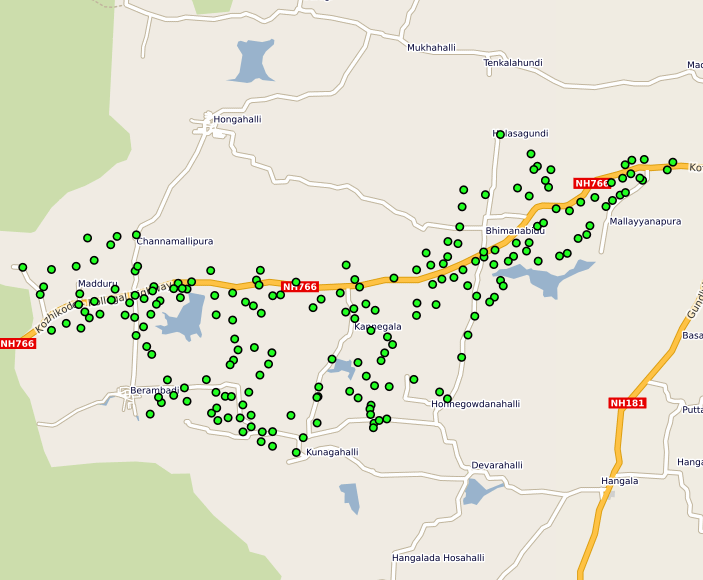
This vector map indicate the Berambadi Monitoring Borewell Locations
-
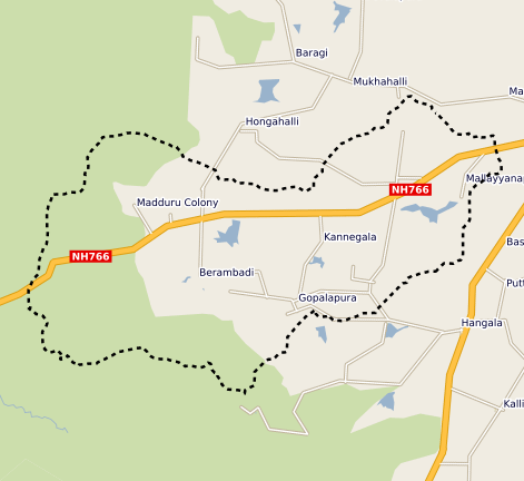
This vector map delineate the boundary of the Berambadi watershed
-
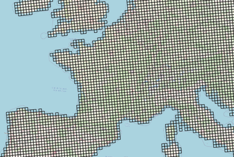
Données météorologiques Agri4cast basées sur des observations et spatialisées sous la forme d'une grille composée de mailles carrées de 625 km² (25 km ×25 km) sur la France. La table attributaire de cette couche permet d'établir le lien entre l'objet géographique (la maille) et les chroniques d'observation météorologiques via un service conforme au standard OGC SensorThings (https://frost.geosas.fr/agri4cast/v1.0/) Les observations sont : - température maximale de l'air (°C), - température minimale de l'air (°C), - température moyenne de l'air (°C), - vitesse moyenne quotidienne du vent à 10 m (m/s), - pression atmosphérique (hPa), - précipitations cumulées (mm/jour), - évapotranspiration potentielle d'un couvert végétal (mm/jour), - rayonnement global total (KJ/m2/jour). Les données météorologiques sont quotidiennes de 1979 à la dernière année civile révolue. Plus d’informations sur le portal Agri4cast : https://agri4cast.jrc.ec.europa.eu/DataPortal/Index.aspx
-
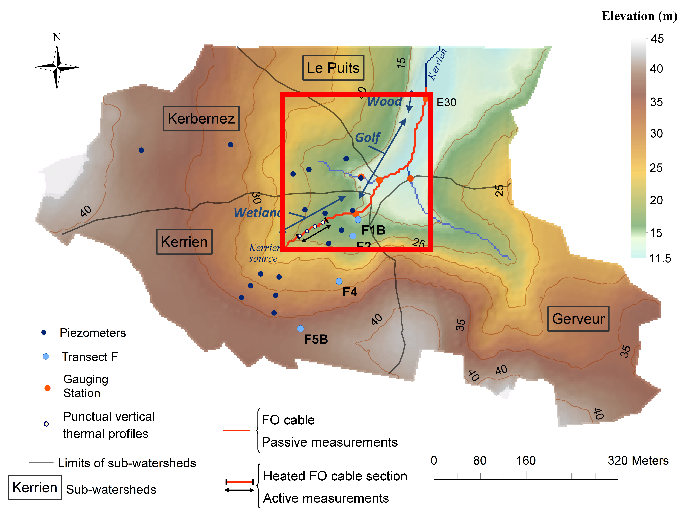
Data corresponds to the long-term monitoring of streambed sediments conducted in Kerbernez through Fiber Optic (FO) DTS technology. The streambed temperature is continuously monitored at high resolution all along the FO cable in order to highlight and quantify groundwater/stream exchanges. Further details are available in the file: http://agrhys.fr/BVE/nataline/mesurespassives/infos.pdf and results are presented in Simon et al. (2021)
-
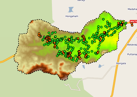
International Action AICHA - Adaptation of Irrigated Agriculture to Climate Change in India. Berambadi Site.
-
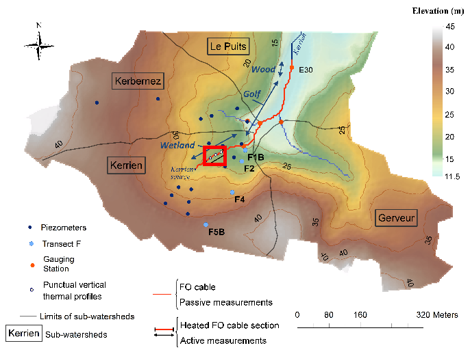
Data corresponding to the active-DTS experiment conducted in Kerrien by deploying and burying an heatable FO cable in the streambed sediments (in the wetland area). Further details are available in the file: http://agrhys.fr/BVE/nataline/mesuresactives/infos.pdf and results are presented in Simon et al. (2021)